Geekiness and rail ownership
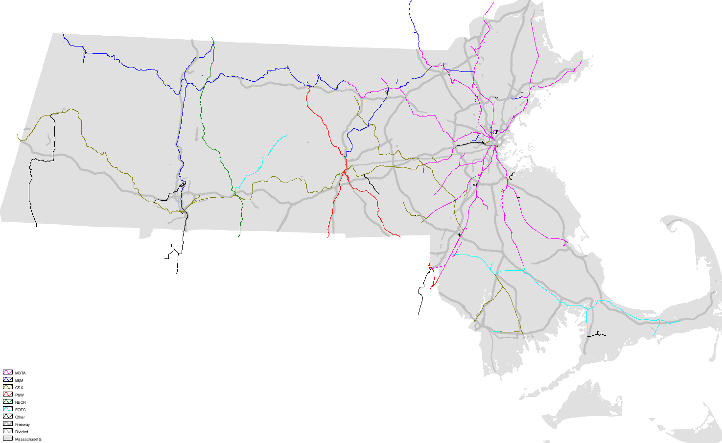
Sep. 27th, 2007 08:51 amSo first off, UMN Mapserver is a fairly nice, fairly straightforward map-rendering tool. It can handle most off-the-shelf datasets with the right configuration, so it's easy to download data layers from MassGIS and plug those in. So you might, if you were me, come up with a map showing who owns which active rail lines in the state.
The big surprise to me is that the state Executive Office of Transportation and Construction has substantial holdings, including the line east from Attleborough through Taunton to the Cape and the line northeast from Palmer. The MBTA owning several key lines means that some rail networks are disjoint; most obviously PAR's (in this map as "B&M" still) but also CSX, which has disconnected lines from Taunton south to Fall River and New Bedford and beyond the end of the Franklin commuter rail. The MBTA holdings also include track beyond Needham Heights as far as MA-9, southwest from Needham Junction to past the CSX crossing in Medway, beyond Lowell station to the New Hampshire border, and a couple of random bits of track I was sure were dead by now.
The big surprise to me is that the state Executive Office of Transportation and Construction has substantial holdings, including the line east from Attleborough through Taunton to the Cape and the line northeast from Palmer. The MBTA owning several key lines means that some rail networks are disjoint; most obviously PAR's (in this map as "B&M" still) but also CSX, which has disconnected lines from Taunton south to Fall River and New Bedford and beyond the end of the Franklin commuter rail. The MBTA holdings also include track beyond Needham Heights as far as MA-9, southwest from Needham Junction to past the CSX crossing in Medway, beyond Lowell station to the New Hampshire border, and a couple of random bits of track I was sure were dead by now.